
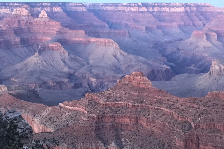
The look on Jana’s face said it all. Eyes like saucers, jaw agape, soundless and awestruck. Beth-Rose just looked happy. Repeated “Oh My God” several times. After two and a half days of driving, we had arrived at the rim. Dusty, exhausted, and more than a little frayed around the edges.
But all of that melted away the moment we stepped up to the rim and took in that first jaw-dropping view. It was everything we’d hoped for—and maybe more. With the canyon stretching endlessly before us and the chaos of the road behind us, it was finally time to breathe, regroup, and celebrate something even more special: Heather’s birthday. A real dinner. Real seats. And no one asking, “Are we there yet?”
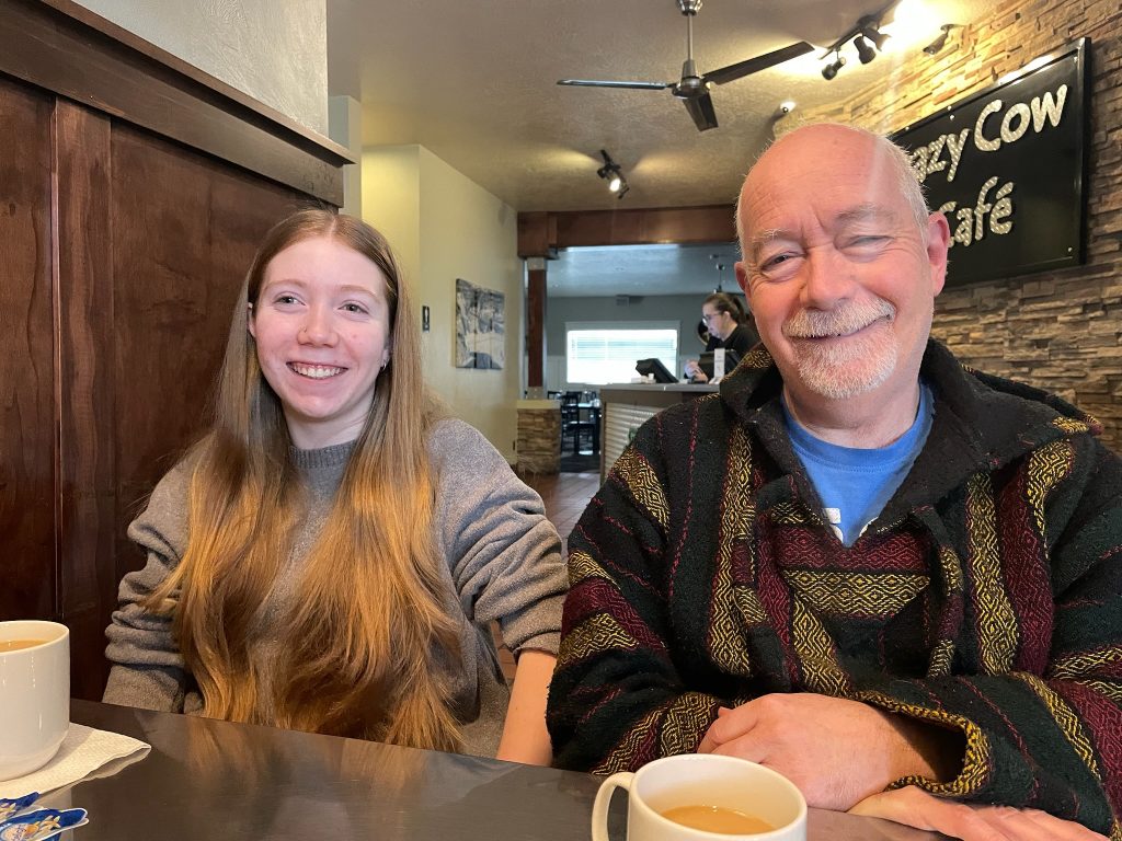
We had been up early after our late arrival in Beaver. It’s Saint Patrick’s Day, which means it’s also Heather’s birthday. A nice breakfast at the Crazy Cow Café, and we’re off southbound again. Next stop; Arizona!
Throughout most of the drive, the temperature hasn’t been particularly warm. The days barely get up to 10 C, and it’s been cloudy. And this day appears to be no different. I’m longing for some warm sun on my face, but it’s yet to happen. Feels a bit like we’ve brought our weather with us!
Redrock Country
But the terrain has definitely changed. We’re in red rock country now, the distinctive southwestern brick-red rocks and sand are everywhere. Just north of Kanab, Utah, the highway bends and unwinds through a landscape that feels ancient and untouched. The red rock walls rise gradually, sculpted by millennia of wind and water. Here, the road becomes less of a route and more of a thread stitched through the fabric of the Colorado Plateau. There’s little in the way of signage or structure—just long stretches of silence broken by the hum of tires on asphalt and the odd raven or hawk casting its shadow across the rocks.
Driving deeper into canyon country, the terrain shifts from broad sandstone escarpments to narrow corridors framed by slickrock and low juniper trees. The land’s palette—ochre, rust, bone-white—is stark and deliberate. Now and then we cross dry washes, an indicator of the rare but violent rains that carve the landscape.
Now and then, a dirt road branches off, leading who-knows-where, promising solitude and maybe a little adventure for those willing to leave pavement behind. The air smells faintly of red dust and wet sage.
Welcome to Kanab
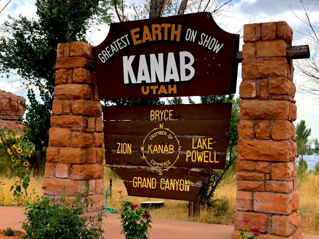
But we stuck to the main highway, US89 South, and found ourselves in the cool little town of Kanab.
Set between towering red cliffs and wide-open desert, Kanab feels like the kind of place where time moseys instead of marches. The main street, lined with mid-century motels and Western-themed storefronts, looks like it was built for a movie set—and, in many cases, it was. Hollywood once loved Kanab so much, they called it “Little Hollywood,” and more than a few locals still have stories of John Wayne ordering breakfast or a film crew blocking traffic with a herd of fake cattle.
Strolling through town, you’ll spot murals of cowboys and pioneers, a movie museum tucked behind an old trading post, and maybe even a real cowboy or two, not just the kind on postcards. Buildings tilt toward the cinematic—a saloon-style restaurant here, a classic neon sign there. There’s a sense that Kanab knows exactly what it is and doesn’t feel the need to update its look just because the calendar says it’s 2025.
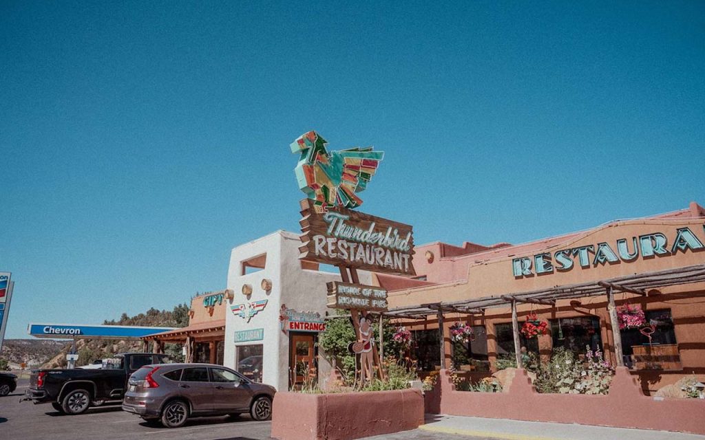
But it’s not all retro Western kitsch. Kanab has a quiet confidence and a growing energy. You’ll find an espresso bar just down from the old stockman’s hotel, a vegan lunch spot next to a feed store. And somehow, it all just works. This is a town comfortable in its boots. Kanab, we all agreed, is a place we’d like to come back to, stay awhile, and get to know it a little more. A good place to kick the red dust off.
Wrong Way to Arizona
I was so captivated by this funky little desert town that I completely missed the turn. Kanab sits on the Colorado Plateau just north of the Arizona border. Our route takes us east, parallel to the border but never quite crossing it. But there in front of us was the “Welcome to Arizona” billboard. Oops!
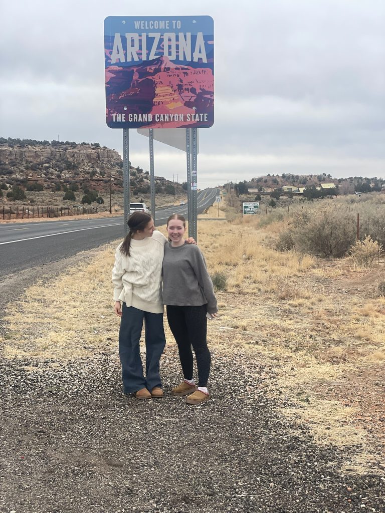
So we stopped for the obligatory photo, then turned back to Kanab in search of our route. Back through the funky cowboy hangouts, the mom and pop motels, and the western souvenir shops, until we found our turn.
For the next 80 miles or so, the road stretched across dry, ochre desert. To the north, the wrinkled and twisted red hills marched on, the occasional dirt track leading off and into some narrow slot canyon. On the right, south, the plains spread for miles to the distant Coyote Buttes and White Pocket, across the line into Arizona. Empty country, but for an old desert rat, this was Paradise!
Everyone was beginning to feel excited. We were nearing the Arizona border, the correct crossing this time. And that meant we’d soon be seeing the Colorado River.
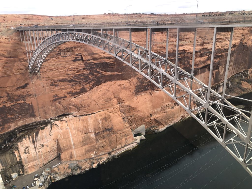
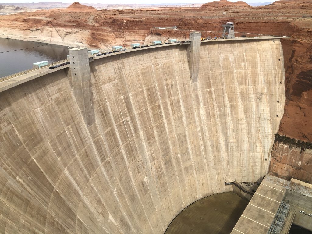
And then, just like that, we were in Arizona. The road dropped down into a series of winding canyons, and then we saw Lake Powell in the distance. This manmade lake, created in 1963 with the construction of the Glen Canyon Dam, is a popular marine and desert recreation area. You can rent a houseboat for a family getaway, right in the middle of the desert!
Glen Canyon and The Eco-warrior
But while the lake is certainly pretty, the flooded canyon that once dominated the region was even more spectacular. Glen Canyon was once considered one of the great natural wonders of North America. But the demands for water storage and hydroelectric power outweighed the opinions of the many environmental groups opposed to such a megaproject. Glen Canyon was public land, not under the protection of the National Park or Monument systems. Without that protection, the dam was authorized and built. And so the extensive, beautiful canyon ecosystem was lost.
One of my favourite authors, Edward Abbey, wrote Desert Solitaire, about his time spent as a park ranger at Arches National Park in Utah. Abbey was a naturalist, a university professor, and a bit of an eco-warrior. He wrote extensively of his love-hate relationship with the National Park Service, park visitors, and the siren’s call of the desert. He had a reputation for driving out into the desert night and burning billboard to the ground.
In Desert Solitaire, he mourns the loss of Glen Canyon, and rails against the “cancer” of urban growth and its insatiable need for water. My favourite Abbey quote: Growth for the sake of growth is the ideology of the cancer cell.
Ed’s gone now, and the dam is still here. And that too, is a sad thing. But we stopped at the visitor center at the Glen Canyon Dam anyway to take it all in. Sorry Ed!
The Visitor Center
And it was warm when we got out of the car! For the first time since never, the air was warm and dry. And I was happy.
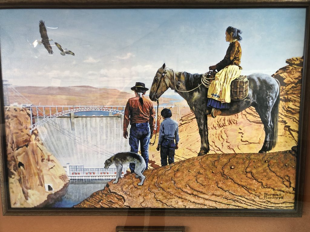
The Carl Hayden Visitor Center is worth a visit, if you happen to be wandering down US89 into Arizona. There are films about the Colorado River, and the construction of the dam, and some historical documentaries, and the interpretive center has a wealth of information on the geology and history of the area.
There’s even a reproduction of a painting by Norman Rockwell depicting a Native family looking down at the dam. I don’t know how people interpreted the painting when it was first unveiled, but to me it evokes a deep sadness. The family looks forlorn and defeated. Pretty much sums up what many felt after the dam was completed.
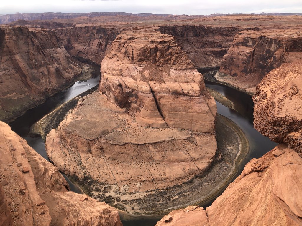
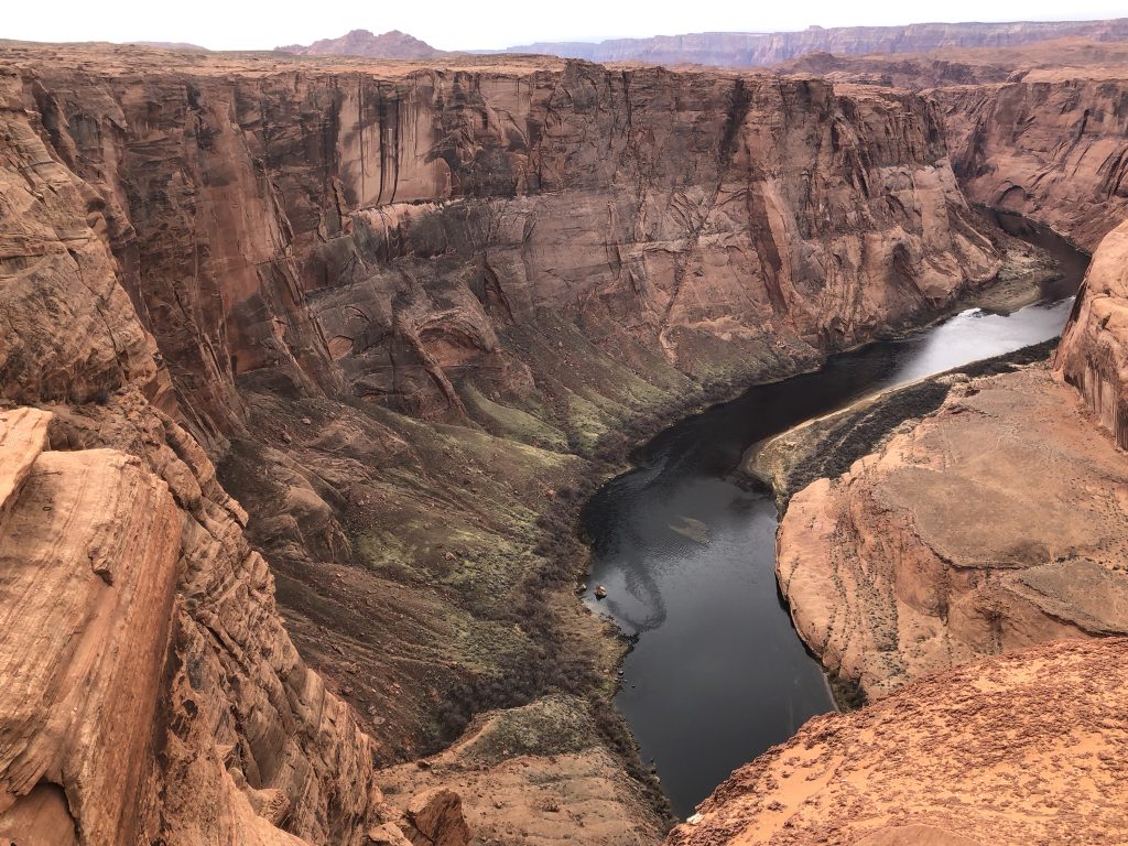
Horseshoe Bend
Back on the road, we cross the bridge without looking down, and drive just a little way past the town of Page. Our first hike of the trip will be to Horseshoe Bend, an overlook trail above a section of the Colorado River as it approaches Marble Canyon.
I stopped here some 25 years earlier to walk to the overlook. The parking lot was a small, dirt lane that had room for maybe 10 cars. The trail cut across the desert scrub in a straight line to the edge of the canyon. It looks a little bit different today.
The parking lot is massive, accessed through an entrance where attendants in a nice, air conditioned booth are happy to take your money. Yup, they’ve turned it into a full-fledged tourist attraction! 20 bucks a vehicle, and now we get to walk along a wide, graded trail (road!) that meanders for a kilometer or so, before you’ve arrived at the rim of the canyon. And when I say “you”, I mean you and 300 other people.
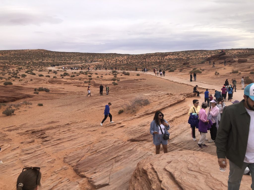
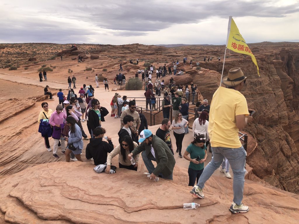
Oh well, the view was still worth it.
But we still have 130 miles to go before we reach our final destination of this first part of our epic road trip. So we’re back in the car and driving south once more.
Over the course of the final 130 miles the temperature fluctuated wildly. At Horseshoe Bend it was about 24 Celsius. A little further south it climbed to 27, then, as we began to climb up out of the desert toward the Coconino Plateau, the temperature dropped steadily. We were going from an elevation of 4,200 feet up to 7,200 feet.
Arrived At The Rim
By the time we reached the Grand Canyon National Park boundary, the temperature was back down to 14. Oh well.
But we had finally arrived at the Grand Canyon! Well, the park anyway. Just another couple of miles to get to Desert View, where we’d get our first look at the Canyon proper.
Our route brought us in from the less traveled east. The main entrance, south of the Village and adjacent to the town of Tusayan, was the busy one. According to the Grand Canyon Facebook page, there could be 2-3 hour waits during Spring Break. So the east entrance looked more appealing. Plus it was already on our route!
Sure enough, when we pulled up to the entrance station, there were only 4 other vehicles ahead of us. The friendly ranger greeted us warmly, and warned us the temperatures overnight could dip below freezing. “But you guys are from Canada, so you’ll be fine.” That’s right, we keep our igloos at a toasty +3 during the day, so a nighttime temperature below freezing just means we have to put on our seal skin pajamas and light the whale blubber lamps.
Through the gate, we still had about 25 miles to drive to Grand Canyon Village and Mather Campground. So we decided to stop at Desert View for the girls to have their first view of the Grand Canyon. Desert View was just over a mile from the entrance.
Once parked, we walked the short distance to the viewpoint next to the Watchtower. Designed by Mary Colter, a pioneering architect, and one of the very few women architects in her day, the Watchtower was built in 1932. It stands 7 stories high perched on the very rim of the canyon.
The View That Keeps Going
It was chilly with a stiff wind as we stepped out to the railing. We had arrived at the rim. And there it was!
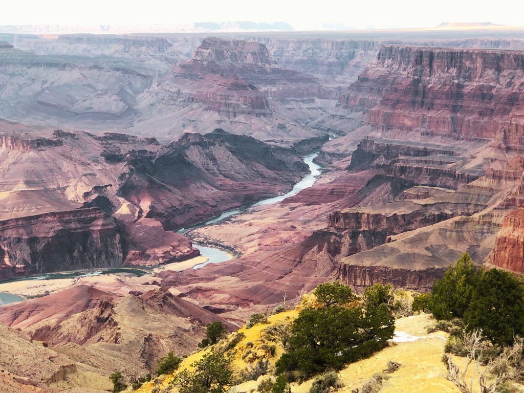
That’s the view that stopped Jana and Beth-Rose in their tracks. That is a view I will never get tired of.
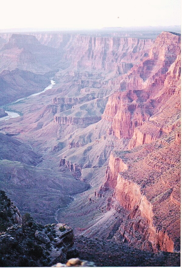
I’ve been to this spot at Desert View 5 or 6 times over the last 35 or so years, and each time it looks a little different. It all depends on the light. The ever-changing palette of light on rocks simply never gets old. Here in the canyon, light is not just illumination—it’s transformation. From first light to dusk, the canyon becomes a living canvas, each hour reshaping its contours. At sunrise, the colors are hushed and muted. Blues and violets dominate the shadows, while the highest rims catch the earliest glow, turning the sandstone walls a pale rose. Without a hint of breeze, the stillness at this hour makes it feel like the canyon is holding its breath.
By late morning, the sun climbs higher, and the full spectrum begins to emerge. Reds deepen, whites brighten, and subtle greens and ochres surface along the layered cliffs. The canyon flattens out, seemingly hiding its deep nooks and crannies. Every overlook offers a slightly different version of the same story: ancient stone reacting to the present moment.
Come late afternoon, the drama builds. As the sun drops, shadows stretch, carving the landscape into high relief. The reds go bolder, the purples richer. Then, at sunset, the canyon puts on its quiet finale. The light softens, then drains, turning the walls into silhouettes. Colors retreat into shadow, not vanishing but waiting—held in the rock—until morning comes again. And every day, a new display to please the visitors.
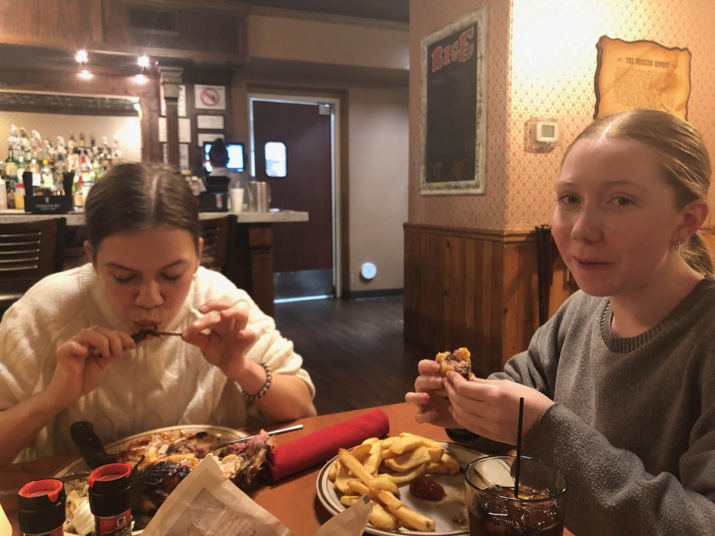
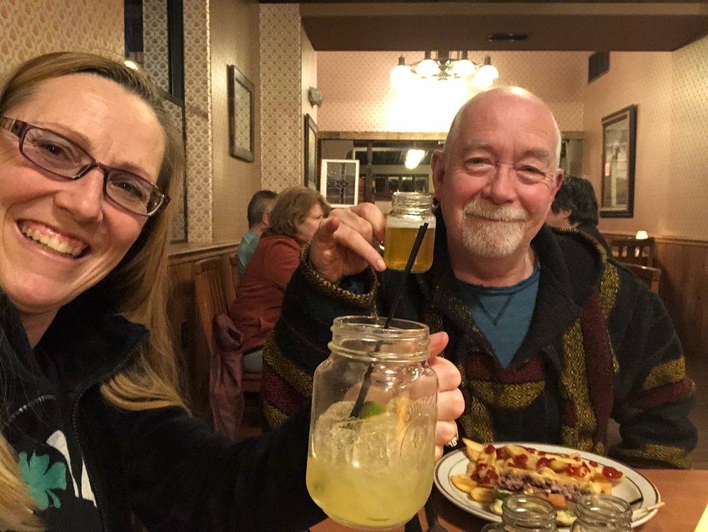
Birthday Girl
The afternoon was getting on, and we needed to get to the campground, find our site and set up. I’d promised a nice birthday dinner for Heather that didn’t include huddling around a smoky fire with a plate of lukewarm beans. So we were going out on the Town!
Mather Campground is huge, with over 320 sites for camping. And although we were in Spring Break, the campground was only about half full. We found our site easily, and got the tents up and everything unpacked for our 5 days here. The wind was brisk and the temperature was dropping. We were going to find out how good our mattress insulation was.
Everyone back in the car as we headed to the town of Tusayan, just south of the Grand Canyon Village. Located just outside of the park boundary, Tusayan serves as the jumping-off point for Grand Canyon excursions and adventures.
Our original plan was to have a nice dinner and then watch the Grand Canyon film at the IMAX theatre in Tusayan. But the day had sped by, so the film would have to wait for another night. Dinner was the priority this night.
Tusayan has a population of about 600 souls, spread over a really small area. Just a mile form the south entrance to the Grand Canyon, the town runs about 1/2 mile from one roundabout to the next. Which makes it really easy to cruise through town looking for suitable restaurants. Get to the end, drive ’round the traffic circle, and do it again!
This is Arizona, so naturally you’ll find a steak house here. Didn’t expect to find 3! So we picked the one that looked the busiest. That was the Big E Steakhouse. And though the ambience wasn’t the greatest, the food was delicious.
And so we had arrived at the rim, and had gotten settled in. Two and a half days of driving with very few issues, at least after the border, and we were at the Grand Canyon. And for the next five days we’d be exploring the village, checking out the attractions on the rim, and getting in some serious hikes. I was ready!
Or so I thought…
[…] days of shivering at the rim of the Grand Canyon, bundled in layers like we were preparing for a polar expedition, the promise of warmth drew us […]